Monday, July 26, 2010

Mt. Adams Team Overnight Snow Training - Hayden Glacier, Middle Sister July 24th - 25th, 2010


This was our "rehearsal climb" hike that gave us a chance to test out our gears such as our mountaineering boots, to spend a night at a camp site, and to do some more technical training.  For whatever reason, Hayden Glacier on Middle Sister was chosen as this year's site.  But this turned out to be a great choice as this trip was simply gorgeous. 

Hayden Glacier carpeted the northeast slope just below the col between Middle Sister (the left peak in the above image) and North Sister.

The plan was that Geoff and I would camp the night before at the trail head and meet the group in the morning there.  In the party were all nine Mt. Adams team members: Matt K, Matt C, Wendy F, Wendy B, Larissa, Laura, Karlene, Geoff, and myself.  Joe Owens from Timberline Mountain Guides led the trip assisted by Jennifer and Heather. 

I would like thank Wendy F. and Laura in advance for letting me use their photos in this post.

Here's the itinerary Jennifer sent us.

****************************************************************
RTS MT ADAMS PREP COURSE


Itinerary:

Meet at the Pole Creek Trail head. Please see directions below.

Time: 9:00 AM Date: July 24, 2010

Special Notes: Please be aware that you will need a trail head parking pass to park here. You can purchase a trail head parking pass from any Forest Service Ranger Station.

DIRECTIONS TO POLE CREEK TRAIL HEAD:

From the town of Sisters, take HWY 242 West. Take a left on FS Road 15, which is Pole Creek Road. Follow the road to its end, always following the signs for Pole Creek. At the end of the road is the trail head. Allow approximately 30 minutes from HWY 242 to the trail head as it is dirt. A trail head parking pass is required.

Day 1: Please bring all of the gear on the equipment list to the meeting point. After a gear check, orientation and dispersal of group gear, we will then hike in to and set up base camp. The approach to camp takes approximately 4 to 5 hours. Depending on the site we choose, the elevation of camp is between 6000’ and 7000’. After setting up our tents and eating lunch, we’ll conduct some basic mountaineering skills instruction.

Day 2: We may cover basic snow camping and advanced climbing techniques, glacier travel and roping techniques. After completing the instruction we will break camp and descend back to the trail head.

What’s Included:

We supply the tents, cooking gear, and stoves. You will pick up your boots, crampons, ice axe and helmet at The Mountain Shoppe. The Lung Association will cover the cost on the rental equipment.

What You Must Bring:

Please bring all the gear that is on the equipment list. Please read the list carefully and call if you have any questions. Be sure to bring lunch and snacks for each day of your program and water for the first day. Once we arrive at camp we will be melting snow for water. Please bring a dehydrated meal for dinner and oatmeal for breakfast.

Rental Equipment:

We are making arrangements to have you pick up your rental equipment at the Mountain Shoppe on NE Broadway. Please let me know if there is a piece of equipment that you do not need.
 
****************************************************************
 
 
July 23rd 

As luck would have it, I had to work until 9:15pm.  So by the time I met up with Geoff in the parking lot of REI in Tualatin, it was pushing almost 10pm.  But first thing first - I had not eaten all day and I needed to swing by a fast food Chinese joint on my way there.  Geoff was already waiting for me in the parking lot and we quickly transferred all his gear in my Jeep. 

I realized that he didn't have an ice axe or boots with him.  It turned out the people at the Reach The Summit designated climbing shop told him that he didn't need to take the equipment with him when he went over there.  Huh??  But we completely lucked out this time.  It just so happened REI was having a used gear sale the next day and the employees were still working in the store getting ready for it even though it closed at 9pm.  Geoff somehow managed to talk one of the managers into letting him rent the necessary equipment from them.  Phew!!

Once all that was taken care of, we hit the road and started driving southbound on I-5 towards Salem, OR.  From there, we would take Hwy 22 and 20 to Sisters, OR.  The Forest Service Road 15 meandered through the woods just southwest of Sisters for a little over ten miles to the trail head.  I was actually surprised to see how wide this road was and how well it was maintained.  Then we realized we forgot to bring a NW Forest Pass that was needed to park there.  But there was nothing we could do about that at this point so we just decided to hope for the best.

The campground at the trail head was well equipped, complete with picnic tables and a very clean outhouse.  We saw a dozen or so cars already parked there.  We quickly set up a tent and crashed for the night.  We didn't even bother to tie down the tent.  In fact, we probably didn't even need to put the fly on either We planed to get up at 7am the next morning.  It was already 2am.

*********************************

July 24th

I woke up just before 7am and started getting ready.  We were supposed to meet with the group at 9am.  I started boiling water on my Coleman stove set up on a tree stump while I sorted my gear in the trunk of my Jeep.  I had no time to deal with packing the night before and had all my gear just thrown together in my backpack and my gear bag.  What a mess! 

We were starting to get worried if we were even at the right trail head when 9am came and went.  We let another fifteen minutes go by before we called Jennifer's cell phone and left a message.  Just then, we saw a big black Beamer rolling in with Jennifer (the RTS head honcho), Heather, and Joe (Timberline Mountain Guides) in it.  They apparently got stuck behind a slow moving vehicle.  And all the other members of the Mt. Adams team started to arrive.

We gathered at the picnic table next to the outhouse and started dividing up the communal items such as tent parts, cooking pots, etc.  Joe also talked a little bit to give us some tips on the subject of packing as well.  I volunteered to carry the main body of the big tent Josh (one of the Reach The Summit training hike assistant) kindly loaned us for this occasion.  Around 10:30am, we were finally ready to start hiking towards our camp site.  This trail head was at around 5,300'.

The trail meandered through an utterly beautiful evergreen forest.  This must be the kind of places where they take those perfect pictures they put in hiking guide books.  Thankfully, unlike the South Sister climb the week before, we were not bothered by the mosquitoes as much either.  As we hiked the gentle climb, we came across a couple of picturesque streams, Pole Creek and Soap Creek where we trotted across the log bridges.  (I almost fell over on one of them...) 

There were a lot of mountain flowers (I didn't know the names) all along the trail and near those streams.  Rather than trying to put into words that wouldn't do justice, I'd just let some pictures do my talking.


And, every now and then, Middle Sister showed itself between tree tops go give us what was to come ahead of us.  And so did Broke Top, North Sister and South Sister.


Thanks to the gorgeous sights that kept appearing around every other bend in the trail, it seemed like we were at our destination campground in no time although my watch was showing 3:30pm by then.  The campground was a well established place right by a narrow snow field just below Hayden Glacier.  It was roomy enough to set up all our tents and more.   Next to the campground was a beautiful small stream created by the snow melt where we we had all our water bottles filled up and brought them up to the "kitchen" where Joe had cranked up all our stoves to boil the water.


In the mean time, we gathered our tent parts and started figuring out how to pitch those things.  It was almost straight forward to pitch the one we borrowed from Josh but we ended up with several mystery parts.  After looking at the instruction, scratching our heads, and looking at the instruction some more, Matt C. figured it out and saved the evening.  There would be four guys crammed into this shake-n-bake contraption. 

Jennifer and Heather had their big bomb shelter tent next to ours and were already in there giggling about something.  There were two other smaller dome tents shared by the ladies as well.  Joe had his personal "single room" next to the kitchen.

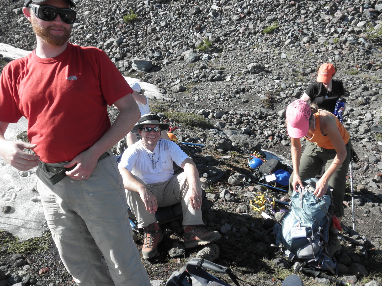
Once all our sleeping quarters were erected, it was time to walk over to the snow field for some snow climbing lessons.  We took all our climbing gears and marched over to the moraine next to it. 

Joe went over everything we had done during the Climber's Clinic in the spring. And it was a good thing - it had been few months since then and we all could use a chance to review and practice the basic snow climbing techniques, such as kick stepping, duck feet steps, traversing, plunge stepping, ice axe usage, crampon techniques, etc., etc. These probably would be the most relevant skills on our ultimate climb on Mt. Adams. We spent the rest of the afternoon on the snow field until the sun started to get lower on the horizon.


Back at the camp, Joe boiled more water for our dinner.  I had a packet of dehydrated kung pao chicken with rice.  Actually, I think I put too much hot water in it though - it came out all soupy.  Note to myself: use a little less hot water to reconstitute those dehydrated gourmet dishes from now on. 

As the sun set over the horizon, the moon started to take its place.  The moonlight gave a strong sense of 3D to everything we were seeing around us, making the mountains pop out in our views like we were in an IMAX theatre.


For the rest of the evening, we hang out and enjoyed each other's company around the until we started to retire one by one.  I stayed up until it got completely dark outside - I almost felt like I was somehow missing out on something by going to sleep. 

*********************************

July 25th

I awoke with the sun rise.  Besides, it was way too ripe inside the tent with four guys sleeping in it and doing things that went along with sleeping.  I zipped open the tent, stepped outside and took a deep breath of much needed fresh air.  Phew!  Then I went down to the stream to brush my teeth and to wash my face with the icy cold water.  In the mean time, others came crawling out of their tents one by one.

My breakfast consisted of a brie and salami sandwich in a couple of pieces of curry flavored nan at a Trader Joe's.  I washed it down with two cups of hot coffee.  I was kind of skeptical about the overpriced VIA from Starbucks but it was surprisingly palatable.  (No, I didn't pay for the VIA.  Those were trial packets...)

This morning, the plan was to pack everything up and watch Joe demonstrated roped travel with Jennifer and Heather's assistance.  Because ropes are one of the most useful tools guides carried to maintain high degree of control, I guess Joe wanted to have everyone see it at least once or twice although he said ropes most likely wouldn't be necessary on Mt. Adams.

It was about 9am when we strapped our backpacks on and moved out our camp.  Having gotten almost eaten alive by mosquitoes when Geoff and I were coming down from South Sisters in the evening on the weekend before, I was grateful that we would be back at the trail head well before that time of the day. 


The stroll back was as fun and pleasant as it was getting there since we were well rested and there was not much of strenuous activities involved on this trip.  It's funny that the sceneries could look completely different when we were going in the reverse direction. 

Though some of us were having some boot issues and I felt bad for them, it was actually good that they were at least finding out about them now rather than on our ultimate climb the following week.  Joe tried to help them with a limited degree of success.

Jennifer made sure we kept moving by yanking on the invisible "short rope" she got on Joe whenever he stopped and started telling us some stories in the middle of the trail. 

When we were taking a real break at one point, something quite magical happened.  There was an orange butterfly that landed on Wendy F's hand and apparently became quite fond of her.  Since she had an orange shirt on and carrying an orange Nalgene bottle, may be that was his thing.  Even after she gently let the butterfly off her hand, he insisted on landing on her anywhere it could.


We were back at the trail head by 12:30pm when I saw somebody standing by the trail head sign with a clip board in his hand.  There was what looked like a ranger badge stitched on his backpack too.  All of sudden I remembered that I didn't have my NW Forest Pass in my car and cursed under my breath.  When Geoff returned from fetching my Jeep and told me that there was no ticket, we both had a big sigh of relief.  It would have been an expensive one.  We lucked out - Phew!!!

I threw all my gear back in the Jeep.  Ahhhhhh!  I love this part - taking off my boots and socks.  There is no relief quite like it.  (It always reminds me of a scene from "Plane, Train, and Automobile" where John Candy takes off his nylon socks in a crowded airplane :D)  I changed into a fresh T-shirt and a pair of shorts as well.  Simple things like these could really make one feel reborn.  Once everyone was back down safely, we congratulated each other and departed our ways.  Geoff and I were going to get something to eat with Jennifer, Heather, Joe, Wendy F. and Larissa at a small burger joint called Snow Cap in Sisters but there was a long long line of crowd when we got there.  We gave up on that idea and said our good byes. 

Next weekend, nine of us will be doing our ultimate climb at Mt. Adams!!!  This is what we've been training hard for the past several months.  STAY TUNED!!!!!!!!

Friday, July 23, 2010

Non-RTS Climb - South Sister July 18th, 2010

Geoff Janke, one of the many friends I met through the American Lung Association's Reach The Summit program, and I set out to climb South Sister on July 17th - 19th, 2010. His wife, Hilary, his ten years old son, James, Geoff and I drove down to spend few nights in Bend, OR where his sister, Erin, and her fiance, Chris, generously let us stay at their house.


July 17th

I drove over to Geoff's house bright and early around 8am and piled into their Jeep with his family. I had never spent any significant amount of time with Hilary or James so it was a great chance for us to get acquainted with each other as well. We took I-5 to Salem, OR where we picked up Hwy 22 and 20 that followed pristine North Santiam River southeast bound via Detroit and Sisters to Bend. The weather was gorgeous like it had been ever since the summer finally arrived in the Northwest and the drive through the Cascade was absolutely beautiful. Every time I saw something like this, I could not help but appreciate how lucky I was to be able to actually live here. As expected, there were a lot of weekend warriors on the road equipped with RVs, boats, etc. but we never hit a traffic surprisingly.

We arrived at Erin and Chris's house around 1pm. After exchanging hellos, we headed out to one of their favorite microbreweries for lunch. One of the benefits of living in Oregon - you would never be short of great breweries to go to and food was fantastic. It was only several blocks away from their house so we just walked over to the restaurant.

The climate in the central Oregon east of the Cascade was dramatically different from that in Portland area. It was more typical of high desert - the sun baked us during the day time to push the temperature to mid 90s but the extremely dry air made it comfortably tolerable. At night, the thermometer reading plummeted to low 40s but nothing like a layer of jacket could not take care of. Ever since my wife and I moved to Oregon, I had always felt this was like a place where somebody just took the best parts of what this country had to offer and threw them all into this area. All within few hours of driving distance at most, we had mountains, rivers and streams, ocean, and deserts.

After the lunch, Geoff and I borrowed Erin's pickup to run some errands in preparation for our climb the next day. The first stop was REI to pick up the liner gloves Geoff had had put on hold along with few other things. After that, we went over to Mountain Supply of Oregon to rent climbing boots and an ice axe for Geoff. They carried Koflachs which I had heard a lot of good things about in terms of comfort. (Even here, there was a sign that read "Free Beer" :D) The last stop was Trader Joe's. I had a standard list of food that I had fine tuned down to the ones that worked well in climbing situations. I was a bit disappointed that they did not carry the kind of salami virtually all other TJs carried. But not a big deal.

After we dropped off the stuff at the house, we went back out again to go check out the trailhead. It was located right on Cascade Lakes Highway about 28 miles west of Bend, directly south of South Sister by the lake called Devils Lake. And it was a good thing we decided to scout it out too.  All the information we had led us to believe that it would be on the north side of the highway but, in reality, the sign for it and its parking lot was on the south side. So we ended up passing it and found it after we made a U turn only because we happened to decide to check out the signed entrance into the parking area on the "wrong side" of the highway. I would have hated to have to do all this super early next morning.

By the time we returned to the house, it was already 7pm and they were getting ready to throw a BBQ dinner in their backyard. Sweet! Geoff started a nice fire in the pit in the mean time. That was when we truly realized how dry it was there. It almost instantly caught fire and we had a blazing flame shooting out of the pit only within few minutes. And the food was great!! There was nothing like cooking and eating outside. Beer flowed generously and we quickly settled around the warm fire under the starry sky.


July 18th

I woke up around 4am to get ready and leave for the climb. Geoff was already in the kitchen cooking up some breakfast burritos for us. Our goal was to leave the house by 5am so that we'd be able to start our approach by 6am. Once again, we borrowed Erin's pickup and started driving to the trailhead we scouted out the day before. 

About a half way there, we realized that it looked like the pickup was burning more fuel than we expected.  We had a quarter of a tank when we left the house but the fuel gauge was already showing less than a eighth of a tank!  But we were at a point where, even if we decided to turn back, we may not make it back to any gas station open at that hour anyway.  Oh, well.. So we just decided to continue to the trailhead and not worry about it for the time being.  There were about a couple of dozen cars in the trailhead parking lot.

By the time we got everything together and started hiking in, it was already 6:40am.  Once we crossed the highway to the north side, there was a well established trail that led to the bottom of South Sister.  It took us through a beautiful wooded area typically found in this region where tall evergreen trees were common and vegetation were lush.  The approach itself was much harder than we expected and there were a lot of sections that were quite steep.  It would have made a great Reach The Summit training hike if it were in the Portland area actually. As usual, the first fifteen minutes was the toughest when I wondered what I was doing there.  But then that went away, also as usual.  The trail followed a gully between the Devil's Butte and another hill next to it so there was no way we could get lost but somehow we kept finding ourselves veering off the trail several times. 

After seemingly hours of pounding the dirt, we finally arrive at the top of the approach at 8:06am where the terrain plateaued off and the southern view of South Sister all of sudden loomed ahead of us.  As on Mt. St. Helens few weeks before, I was very pleased to see there still was relatively a lot of snow however severely sun cupped.  We also agreed on the hard turn around time of 3pm.  We'd either summit by then or turn around and start heading down where ever we happened to be by that time.

There was a sign for the summit of South Sister that seemed to point straight ahead from where we were standing.  (By the way, at the time, we did not have the map drawing at the top of this posting which would have made things a lot more straight forward for us.)  And it made sense as what we thought was the summit of South Sister was straight ahead of us as well.  So we decided to strap on our crampons and pressed on straight ahead heading for the right side of Clark Glacier.  At 9:40am, we ran into another sign buried deep in the six foot snow and only the top of it was showing but confirming that we were going the right way.   

We also had a spectacular view of Broken Top to the southeast throughout the whole time we were climbing.  The terrain was progressively getting steeper as we pressed on and it was becoming necessary to kick step up the snow field.  When we reached another plateau, it was becoming very apparent that Clark Glacier we were aiming for was a lot steeper than it looked from the top of the approach.  And something was not quite right here either.  Where were all those climbers who supposedly got here by the two dozen or so cars we saw parked in the lot anyway??  Earlier we saw a couple of hikers as well as a couple of snow boarders but they were nowhere to be found.  After looking around carefully, we spotted far to the right and above us some people going up more or less towards Lewis Glacier.  They were those snow boarders!!  Obviously they knew something we didn't know.

So we decided to traverse climb to the right in order to join the route they were going up on.  We were still kick stepping up the snow field.  By the time we took another break around 10:30am, we had gained quite a bit of elevation and we had an incredible view below of the rock mesa and what appeared to be an eruption crater.  From here, the plan was to continue up towards Teardrop Lake, which was the highest lake in the state of Oregon.

But before we even got there, we had to negotiate a couple of steep moraines separated by a small patch of snow.  The rocks and the scree were incredibly unstable and we had to be extremely careful of our footings.  This definitely was a no-fall zone where sliding down over the cheese grater below us would have been rather unpleasant.

We reached Teardrop Lake at about 9,000' around 1:25pm.  It was starting to get very questionable if we would be able to reach the summit by our hard turn around time of 3pm.  From there, we had a bird's eye view of the path we took and also the "standard" route everyone else seemed to have taken.  Geoff guesstimated that we probably lost about two hours of precious time before we changed our course.  This would become even clearer later on our way back to the top of approach.  Mt. Bachelor was looking mighty pretty to the south. 

Since we were there, we decided that we would go as far as we could.  There was a trail on top of the moraine/ridge that lead straight to the summit.  We could see other climbers coming down on it and it looked like the trail was well developed.  So we opted to take off our crampons a this point and climb the rest of our way without them.

About another hour into it, at 2:26pm, it became very obvious to us that there was no way we would make the summit by 3pm.  Rather than climbing for another a half an hour only to prolong the agony of descent, we decided to call it our summit for this climb.  We were around 9,800'.  (In this picture, I might look like I was wearing a diaper but that's because I had my fleece jacket tucked in my shell pants...)

Now we had to reverse our course and go down the way we just came up.  The only section that was very tricky was the moraines just below Teardrop Lake.  It seemed to us that it was even more unstable than when we climbed it for some reason.  I went down first and, despite my careful stepping, a small debris fall almost started at the top of it.  We were careful not to be on each other's fall line as we made our way down this very precarious area.  Once we got back to the snow field below, we were pretty much home free from there on.  We were able to glissade down most of our way.


We kept running into people who were rather, say, out of place.  For instance, there was a group of guys and girls who appeared to be college students.  Some of them were glissading with only athletic shorts on.  And then there was this guy we saw almost two thirds of our way down around 4pm.  He was dressed only in a polo shirt, a pair of athletic shorts, and a pair of moccasins.  He was not carrying anything either.  Not even a bottle of water.  We asked him where he was going and he said he was going all the way up to the summit!!  Geoff had to tell him that he would freeze to death if he got stuck up there and convinced him to turn around.  What the ....???

Once we got back to the bottom plateau area, we stuck with the "standard" trail that took us by Moraine Lake.  Actually, it was more of a well maintained narrow road than a mountain trail.  Like Geoff was saying earlier, it definitely would have saved us a couple of hours had we gone this way when we saw the first sign.  Much faster than walking over the sun cupped snow field for sure.

But this "standard" trail seemed to go on and on forever.  It should take us right back to the first sign we saw at the top of our approach.  However, the sign was nowhere to be seen and we were starting to think that maybe we somehow strayed off the trail somewhere.  So much so that, we decided to take a compass bearing off of a prominent land mark, Devil's Butte in this case, to make sure that we knew where we were going.  Geoff also pointed out the unique foot prints he had been tracking and we were quite certain where we were.  Sure enough, after walking another ten minutes or so, we found the sign in question.

Because of the time pressure, we were yet to have our lunch.  By then, we were so hungry that we had to stop to have some meal before we started down on the approach trail.  And what a diffence it made!!  we felt so much better now.

It was a hell getting back to the parking lot.  We almost got eaten alive by thousands of huge mosquitoes quite literally.  It was dusk and the worst time of day to be in the woods too.  Because I kept my fleece jacket on, I was not as affected by them as Geoff was.  By the time we finally jumped in our pickup and drove off, he must have had at least a hundred mosquito bites all over himself.  This was something to remember for our RTS overnight training the following weekend as well as for our Mt. Adams climb two weeks later - I made a mental note to myself to email Jennifer, the Reach The Summit head honcho, about bringing bug sprays.  It was about 7:30pm. 

We were so thankful that there was just enough gas in the tank for us to get back into town.  Running out of gas was the last thing we needed.  We were utterly exhausted when we finally made it back to the house.  Erin and Chris offered to crank up their BBQ grill and cook up some burgers and franks for dinner.  Hilary made fantastic potatoes to go with them.  Like the night before, we sat around the fire for the rest of the evening enjoying hanging out with beers in our hands.


July 19th

All good things must come to an end.  We all went out for a breakfast together before we thanked and said good bye to Erin and Chris.  We took a different route going back to Portland - we headed north towards Smith Rock State Park to pick up Hwy 26 that took us all the way back to Portland.  This was the first time for me to see this part of the state so I was very much enjoying the view from the backseat while we did Mad Libs with James.  We stopped for lunch at Ice Axe, a restaurant on the foothill of Mt. Hood. 


Erin & Chris - Thank you again for everything!!